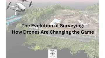
Surveying has long been a cornerstone of infrastructure, construction, and land management, evolving steadily with technological advancements. From rudimentary tools like ropes and chains to sophisticated GPS systems, each innovation has brought new levels of precision, efficiency, and capability. Today, we are witnessing another groundbreaking transformation: the rise of drone surveying.
Unmanned Aerial Vehicles (UAVs), commonly referred to as drones, are reshaping how surveyors collect and process data. This article explores the history of surveying, the emergence of drones, and how this technology is setting a new standard in the industry.
The Journey of Surveying Technology
From Ancient Tools to Modern Techniques
Surveying dates back to ancient civilizations, where ropes, plumb bobs, and measuring wheels were standard tools. The Great Pyramid of Giza and Roman aqueducts are testaments to the ingenuity of early surveyors. Over time, more precise instruments like the theodolite (developed in the 16th century) and levels enabled surveyors to tackle increasingly complex projects.
In the late 20th century, technologies such as Total Stations and GPS revolutionized the field. These devices combined measurements with digital data to achieve unmatched accuracy and efficiency. However, even with these advancements, traditional surveying methods still face limitations, particularly when it comes to accessing difficult terrain or large project areas. Not to mention the risk of people/plant interface that exists on most construction sites.
The Rise of Drone Surveying
Over the past decade, there has been a rise in the number of drones being used for surveying. I remember back in 2015 drones started to become popular toys and gadgets. And then starting to add cameras to the point now where we have drones that can carry different payloads, not just cameras. This makes drones very versatile for different surveying tasks.
What is Drone Surveying?
Drone surveying involves using UAVs equipped with cameras, sensors, or LiDAR technology to capture high-resolution aerial data. The process includes:
- Planning a flight path with specialized software.
- Capturing data through aerial imaging or scanning.
- Processing the collected data into usable outputs like 3D maps, orthophotos, or elevation models.
This approach drastically reduces the time and manpower required for traditional surveys.
Why Now?
Drones are not a new concept, but recent advancements in affordability, ease of use, and sensor technology have made them accessible to a wide range of industries. Regulatory frameworks, such as those established by the FAA in the U.S., or the CAA in the UK., have also paved the way for widespread adoption.
The Advantages of Drone Surveying
1. Unparalleled Efficiency
Traditional surveys can take weeks to complete, especially in large or inaccessible areas. Drones can cover the same ground in hours. This efficiency means faster project timelines and reduced costs.
2. Enhanced Safety
Surveying hazardous sites, such as mines or cliffs, poses significant risks to personnel. Drones eliminate the need for surveyors to enter dangerous areas, capturing data remotely with precision.
3. Superior Data Quality
Drones equipped with high-resolution cameras or LiDAR sensors can collect millions of data points per second, creating detailed 3D models and maps. These outputs are invaluable for engineers, architects, and project managers.
4. Cost-Effectiveness
While the upfront investment in drone technology may seem high, the long-term savings in labour, time, and equipment often outweigh initial costs.
5. Versatility
From urban planning and environmental monitoring to construction and agriculture, drones can adapt to diverse applications, making them an essential tool for modern surveyors.
Key Applications of Drone Surveying
1. Construction and Infrastructure Development
Drones streamline site inspections, volume calculations, and progress monitoring, enabling construction teams to stay on schedule and within budget.
2. Agriculture and Forestry
Drones can analyse crop health, monitor irrigation systems, and even detect pest infestations, providing invaluable insights for large-scale farming operations.
3. Environmental and Disaster Management
Surveyors use drones to map flood zones, monitor deforestation, and assess damage after natural disasters, aiding in swift and effective response strategies.
4. Mining and Resource Extraction
In mining, drones are used to calculate stockpile volumes, monitor slopes, and survey inaccessible areas, ensuring both efficiency and safety.
Challenges and Considerations
While drones are transforming the industry, they are not without challenges:
- Regulatory Compliance: Operating drones often requires adherence to strict regulations, including pilot certifications and flight restrictions.
- Initial Costs: High-quality drones and sensors represent a significant investment, though this is often offset by long-term savings.
- Learning Curve: Surveyors must familiarize themselves with drone technology and data processing software to fully leverage the benefits.
What the Future Holds
As drone technology continues to advance, the possibilities for surveying are virtually limitless. Emerging trends include:
- AI Integration: Automated data analysis and pattern recognition.
- Swarm Technology: Coordinated drones working in unison for large-scale surveys.
- Improved Battery Life: Longer flight durations for more comprehensive data collection.
Moreover, as the cost of drones and sensors decreases, we can expect even broader adoption across industries.
Why It’s Time to Embrace Drone Surveying
The evolution of surveying has always been driven by the pursuit of better accuracy, efficiency, and safety. Drone surveying is the next logical step in this progression, offering unparalleled benefits that traditional methods simply cannot match.
Whether you’re a seasoned surveyor or a professional in construction, mining, or agriculture, now is the time to explore the potential of drones in your projects.
Learn More
Ready to see how drone surveying can transform your work? Why not take a look at the surveyed by drone website to see what can be done and see how you could benefit from having a drone survey of your site.

